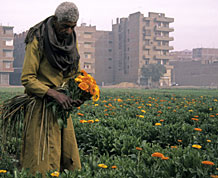
THE GROWTH OF INFORMAL AREAS
In the context of population growth and urbanisation, urban townships often develop independently of formal planning processes, driven by informal market forces rather than by governmental or municipal housing schemes. Between the 1970s and 1990s, an estimated 80% of new housing units in Greater Cairo were built in informal areas. According to a more recent study published in 2000, at the end of the 1990s informal areas represented about 53% of the built residential surface of Greater Cairo and hosted 62% of its inhabitants.1 According to official government figures from 2002, Greater Cairo has 34 km² of informal areas that house 2.1 million (about 1/7 th of the population). GIS-based mapping conducted by PDPâs GIS Unit found that in 2000, in fact 133 km² of the Greater Cairo area are covered by informal settlements, housing almost 8 million people, or 50% of Cairoâs population. In 2006, informal areas occupied 160 km2 and hosted 9.5 million inhabitants.
Â
Â
Â
Â
Â
Â
——————————–
1 Sims, D., 2000: Residential Informality in Greater Cairo: Typologies, Representative Areas, Quantification, Valuation and Causal Factors. ECES, ILD, Cairo.
See also Séjourné, M., 2006: Les politiques récentes de traitement des “quartiers” illégaux au Cairo. Mémoire de Doctorat, Université de Tours.